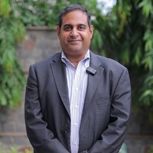
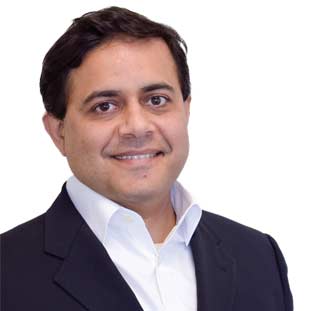
Ashwin Karunakaran, Director
Drone technology is constantly evolving as a new innovation in today’s world and with huge investments being made in this technology, more and more advanced drones are being launched in the market every few months. The days when drones were only used for military purposes are long gone. Today, anyone can buy and fly a drone, and it seems like each day brings with it a new purpose for drones. One of the newest uses for Unmanned Aerial Vehicles (UAVs) is GIS mapping. Drone mapping holds a number of potentials for various sectors such as construction, agriculture, mining, infrastructure inspection, and real estate. Recognizing the budding scope of Drone Technology, Ashwin Karunakaran, a retired Survey of India executive in 2013 establis-hed Birdview Mapping–an expert in Aerial Triangulation, Orthophoto production, Planimetric and DEM extraction from stereo imagery, 3D city modelling and cartographic mapping. The firm integrates its high-performance drones with advanced sensors and software, which are all designed for quick learning and easy use, so one can get clear, accurate picture of the project area, complete with measurements, and is advantageous in terms of decision-making.
"Birdview Mapping has been Drone Mapping since 2014 carrying out back-end office of Drone Data Processing and Photogrammetry mapping for clients in Malaysia Jurukur Perunding Services"
“I got myself trained in 2005 from Survey of India, Hyderabad and got certified in Photogrammetry and Remote Sensing and Cartography Mapping and, thus, started my carrier working in the Biggest Company GENESYS Mumbai in 2007 and learned how the organisation works for quality and no comprise on quality data. I learnt the job of production to QC and handling teams and managing projects.Finally, in 2013, I was ready and registered Birdview Mapping under Indian Law. Started the first project from Geo Digital California USA and we started the run and gave good quality and went on doing projects for different clients and different country and gave good quality. Birdview Mapping has been in the industry of Drone Mapping since 2014 carrying out back-end office of Drone Data Processing and Photogrammetry mapping for clients in Malaysia Jurukur Perunding Services. We have done Airborne LiDAR classification Project called Airport Obstacle mapping and have finished 23 Airports in Spanish territory for client SRM consulting Spain,” says Ashwin Karunakaran, Founder and CEO, Birdview Mapping.
With its talented staff of geospatial experts specializing in Aerial Triangula-tion, Orthophoto production, Planimetric and DEM extraction, 3D city modelling, and cartographic mapping, the company promises a flexible approach and professional service to its clients, giving them an
opportunity to build lasting and stable business relationships. “We have always given our best quality to the customers and have collected data for railways for planning new alignment and offered Drone survey for National Highway for a new alignment of the 4-way road complete topography mapping using UAV photogrammetry stereo mapping which was implemented for accuracy of 2 cm in Vertical and Horizontal. We have also carried Railway projects and River Ram Ganga Hydro project in UP using Drone and got the first chance to do a Drone survey and Mapping for 10km in Kerala for National highway project for IIDC Thiruvananthapuram,” adds Ashwin.
In the international field, Birdview Mapping redefines technology by providing an extended capacity to handle the largest of projects with limited time frame through the utilization of standardized equipment and procedures with the experienced technical workforce. Providing a flexible approach and professional service to its clients, the organization also gives the customers the opportunity to build lasting and stable business relationships. Effective and Quick Execution of orders of the customers and providing the highest quality products and services at competitive prices is the organizations’ main motive. Concluding the interaction, Ashwin says, “We were in the medium pace of generating revenue with small sized international projects years back, but Drones have been in the Indian market and we are making a quick and good profit and hope to see more Tenders by the government in Railway and Road mining.”
In the international field, Birdview Mapping redefines technology by providing an extended capacity to handle the largest of projects with limited time frame through the utilization of standardized equipment and procedures with the experienced technical workforce. Providing a flexible approach and professional service to its clients, the organization also gives the customers the opportunity to build lasting and stable business relationships. Effective and Quick Execution of orders of the customers and providing the highest quality products and services at competitive prices is the organizations’ main motive. Concluding the interaction, Ashwin says, “We were in the medium pace of generating revenue with small sized international projects years back, but Drones have been in the Indian market and we are making a quick and good profit and hope to see more Tenders by the government in Railway and Road mining.”